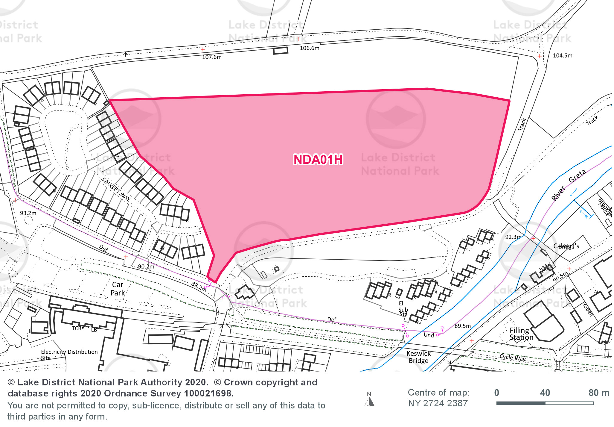
Site area (hectares): 3.20
Use: Housing
Site requirements:
- Heritage Impact Assessment to assess the impact on World Heritage Site designation and heritage assets. In addition a Heritage, Design and Access Statement and a World Heritage Site Checklist would be required.
- Design and layout considerations to integrate with existing settlement and achieve minimum separation distances from existing properties.
- The topography of the southern part of the site offers the most scope for development. Development must be of appropriate scale, design, and layout with a landscaping scheme to mitigate the visual impact of development on the wider landscape.
- Any development should seek to establish a clear boundary, reflecting local landscape characteristics. The establishment of a tree belt would achieve this and further integrate the site into the landscape.
- Access be provided through the adjacent Calvert Way development and a secondary vehicle access should be provided.
- Transport Assessment including impact on Crosthwaite roundabout on the A66.
- Improve sustainable transport infrastructure to link to existing networks.
- Tree constraints plan required.
- Tree survey required.
- Root protection of trees during construction.
- Flood Risk Assessment required.
- Surface water drainage strategy is required which demonstrates that development incorporates SUDS and ensures the greenfield runoff rate is not exceeded.
- Landscape and visual impact assessment required.
- Development needs to avoid any easements resulting from the new water pipeline passing through the site.
- The River Derwent & Bassenthwaite Lake is a designated Special Area of Conservation (SAC) and River Derwent and Tributaries Site of Special Scientific Interest (SSSI) so development, including construction, must avoid adverse impact on the designated watercourse.
- A project level Habitat Regulations Assessment will be required for any development proposal.